 |
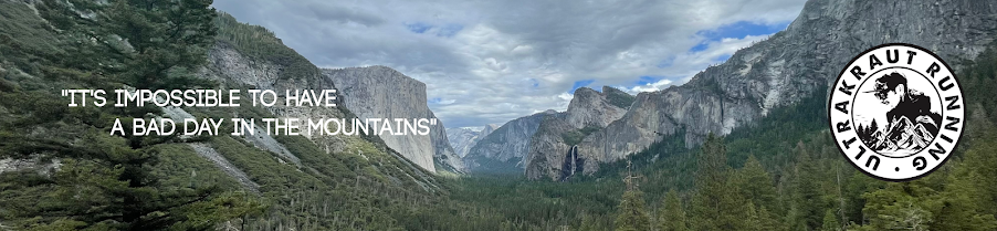
| View from top of Mount Mitchell. |
Some races are clearly meant to be. I struck out in 4 out of 5 race lotteries for 2018. Not so for the 21st edition of the Mount Mitchell Challenge 40 Miler. In fact, I got in on my very first try just like it did in the 2015 UTMB. I considered it to be a sign for another epic adventure.
 |
| All smiles at the start, Chris, Jerry, me and Rick. |
The Mount Mitchell Challenge had been on my bucket list for a while. It is a 40 mile ultramarathon that starts in the small town of Black Mountain in North Carolina and climbs to the top of Mount Mitchell in the Appalachian Mountains, the highest peak in the Eastern US with an elevation of 6,685 feet and a prominence of 6,089 feet. It is said that this race is run in February of each year to ensure the harshest conditions possible. The weather factor coupled with nearly 5,000 feet of ascent over the first 20 miles followed by 20 miles of descending back to town makes this one of the tougher trail running races in the US as past finisher's rates and times can attest.
 |
| Entrance to Mount Mitchell State Park, road section on the course. |
Getting into the race this year could not have been timed any better. I had signed up for the inaugural Hellbender 100 Mile race in this exact mountain range in April, so this would be a great way to see the area and do a challenging race at the same time. I love challenging mountain races and this definitely fit the bill. I've done quite a few, but never one that has 20 miles of climbing followed by 20 miles of descending. the biggest challenge was trying to figure out how to pace of that, but I guess I'd find out on race morning.
 |
| Old Mount Mitchell Trail to top of the peak. |
A total of 3 friends and running buddies from Huntsville, AL had made it into the race via the lottery along with me, Jerry Abbott, Chris Redman and Rick Rawls. Jerry's wife Wonda would be joining in the fun as well to run the Black Mountain Marathon. Rick and I travelled to North Carolina together. Never having been to the Area and the city of Asheville in particular, I had booked us a place in Asheville, which was just a little over 10 miles from the race start. We left early Friday morning to allow ourselves some time to pick up our race packets and explore the area prior to the race.
 |
| Old Mount Mitchell Trail. |
Rick and I arrived in Asheville too early to check in to our hotel, so we decided to drive to the top of Mount Mitchell to scout the most difficult part of the course before heading to race packet pickup in Black Mountain. After the nearly one hour drive to the peak that included part of the beautiful Blue Ridge Parkway, we were greeted by scenic views and mountain peaks as far as the eyes could see. I decided to take plenty of pics from the peak and along the top section of trail as I had decided to not carry my phone on tomorrow's race. The goal was to go as light as possible, a handful of energy gels, some salt and a hand bottle. It was going to be warmer than ever before, so no extra layers would be needed.
 |
| Old Mount Mitchell Trail. |
Race packet pickup was quick and painless. We briefly connected with the rest of the Huntsville gang and headed back to Asheville to check in to our hotel and grab some dinner before getting our race kit ready for the next morning. I had been going back and forth about my plans for the day and ultimately decided to go entirely by feel. A total of 500 runners were registered for either the challenge or the marathon including a few elite runners, so I knew it would be ill advised to try to follow or try to catch anyone ahead of me, especially early on in the day.
 |
| View from top of Mount Mitchell. |
Rick and I arrived about 45 minutes prior to the race start and found what turned out to be the perfect parking spot, about half a mile from the race start downtown, but only 50 yards from the finish line at lake Tomahawk, which would be a welcome site a few hours later. We walked the 15 minutes to the race start, allowing plenty of time to catch up with others and find the rest of the Huntsville crew for an obligatory pre-race photo.
 |
| View from top of Mount Mitchell. |
I lined up in the second or third row at the starting line and when the race start was signaled, we all took off down the street and towards Montreat to cover the first 3 miles of the race on pavement before we would hit the trail leading up to Mount Mitchell. The race course was pretty much uphill for the first 20 miles, some sections steeper than others, some short sections even slightly downhill.
 |
| View from top of Mount Mitchell. |
There were about 20+ runners ahead of me and before we even reached the trail the field had spread out significantly. I still ad no idea how to manage my race with such a unique course profile, so I decided to race entirely by monitoring my heart rate. This was a first for me. The goal was to keep my HR around 150-155 on the way up and to shoot for 160-165 on the way down. I didn't know if that would be too fast for me or not, it just seemed like a reasonable approach at the time. I did not deviate from my plan on the way up and kept it steady.
 |
| View from top of Mount Mitchell. |
Time flew as I went through aid station after aid station, refilling my bottles as I continued on. I followed my fueling strategy of an energy gel every 45 minutes (for a total of 7) followed by salt every 60 minutes. This worked very well once again. I supplemented with a couple of cups of Coke on the way up and on the way down, but that was it for fuel. I reached the marathon turnaround point at the Blue Ridge Parkway intersection in just over 2 hours. Until now, we had been on either single or double track trail, mostly fairly rocky and somewhat technical trail that would require your focus the entire time, especially on the way down.
 |
| View from top of Mount Mitchell. |
The next section of the course had us running on the parkway for about a mile or so before turning right onto the road leading to Mount Mitchell State Park. We'd follow this road for another 2 miles before being lead onto the Old Mount Mitchell Trail, which was a new section for this year's edition. We would follow the trail all the way to the peak, the official turnaround point of the race. A park ranger would mark every challenger's bib with an "S" (for summit, I presume) at the aid station just between the end of the single track trail and the summit. I tapped the geological marker indicating the highest point before I headed straight down the summit path and down the park road. We would now bypass the trail and run straight down the park road for about 4 miles before turning back onto the Parkway for another mile before reaching the marathon turnaround point once again, this time from the opposite direction on our way down.
 |
| View from top of Mount Mitchell. |
It was during this stretch of road between the peak and the parkway aid station that I would be running with the eventual repeat overall female winner and ultrarunner extraordinaire Aliza Lapierre for most of the road section. I had just met her minutes earlier on the trail and was now just trying to hang on for a few miles, if I could. It didn't take long until the conversation turned to upcoming race schedules that included UTMB for both of us. It was fun to swap race stories with such an accomplished runner. Of course, just before we reached the Blue Ridge Parkway AS, Aliza took off, leaving me in the dust as I struggled to swallow an energy gel running 7 minute per mile pace. I did not see her again until the finish:-)
 |
| View from top of Mount Mitchell. |
I had been moving pretty well on this stretch of road, but as soon as we hit the trails again, I seemed to slow. In fact, not long after leaving the AS I was passed by two other challengers, both of whom appears to be around my age. While I did not attempt to chase them down, it did keep me honest. I felt like I had slowed too much, so I tried to pick it up again and to sustain some type of pace. After all, there was still about a half marathon to go, so no time to rest just yet. The views had been absolutely spectacular on the way up, but on the way down, I had to keep my eyes on the trail at all times. This was by no means smooth pine needle single track, it was rocky terrain that was sometimes wet, sometimes muddy and always gnarly.
 |
| View from top of Mount Mitchell. |
I continued to try to keep a steady pace, my HR seemed ok and my legs seemed fine. I passed through the aid stations always making sure to fill up my bottle and before I knew it, I was dropped out on a seep gravel road that turned into an even steeper paved road. This part along with the previous few miles of trail were different from the way up. I had no idea of how far I had left to go until I saw the sign "3 Miles To Go". "That's it?" I thought. Alright, I put my head down and picked up my pace. I had remembered Nathan Holland's words from earlier that morning: "You want to make sure you have something left for the final 5K".
 |
| View from top of Mount Mitchell. |
I continued to push and finally checked my watch. Could I finished close to my "A" goal of 5:30? How close could I get? Only one way to find out. "2 Miles To Go". Ok, this is getting hard. What's that? A block party? Cool. High fives from everyone. Ok, I must be getting close. What? There is a table with free beer? PBR? No way I can drink right now, let's get this done. "One Mile To Go". Where is the finish? Where's the lake. I'm still in the middle of town. Ok, I'm crossing the street. I must almost be there, still no lake. Wait, I hear people. Yes, I'm getting close. There it is, the finish line. Oh no, they really do make you look the entire lake before you finally cross it. Ok, I know I must be sprinting right now. Well, that's probably only how it feels, not how it looks. One more turn and I'm there. Yes!!! Finished!!! And I'm feeling pretty damn good. No puking, no falling over, no crazy cramps. This is awesome! And I'm close to my A goal. What an awesome race!
 |
| View from top of Mount Mitchell. |
Thanks for the creators of this fantastic bucket list ultra and thanks to the RD and the entire crew of volunteers and thanks for the local support. This event somehow manages to maintain the small family type feel of an ultra thatw e all love, yet it is put on as professionally as any event I've ever attended. And the swag and finisher awards were absolutely amazing. I love the Black Mountains!