Showing posts with label Self-Supported. Show all posts

14 May 2020

/


The pandemic struck and one by one my entire 2020 race calendar disappeared in front of my eyes. Nearly every event registration was rolled over to next year, so at least I wasn't going to lose much in terms of registration fees. So, instead, I started signing up for a bunch of virtual races, anything to keep my mind off the big adventures that had been cancelled or postponed. Even self-supported solo adventure runs had to be cancelled due to the large scale park and trail closures.
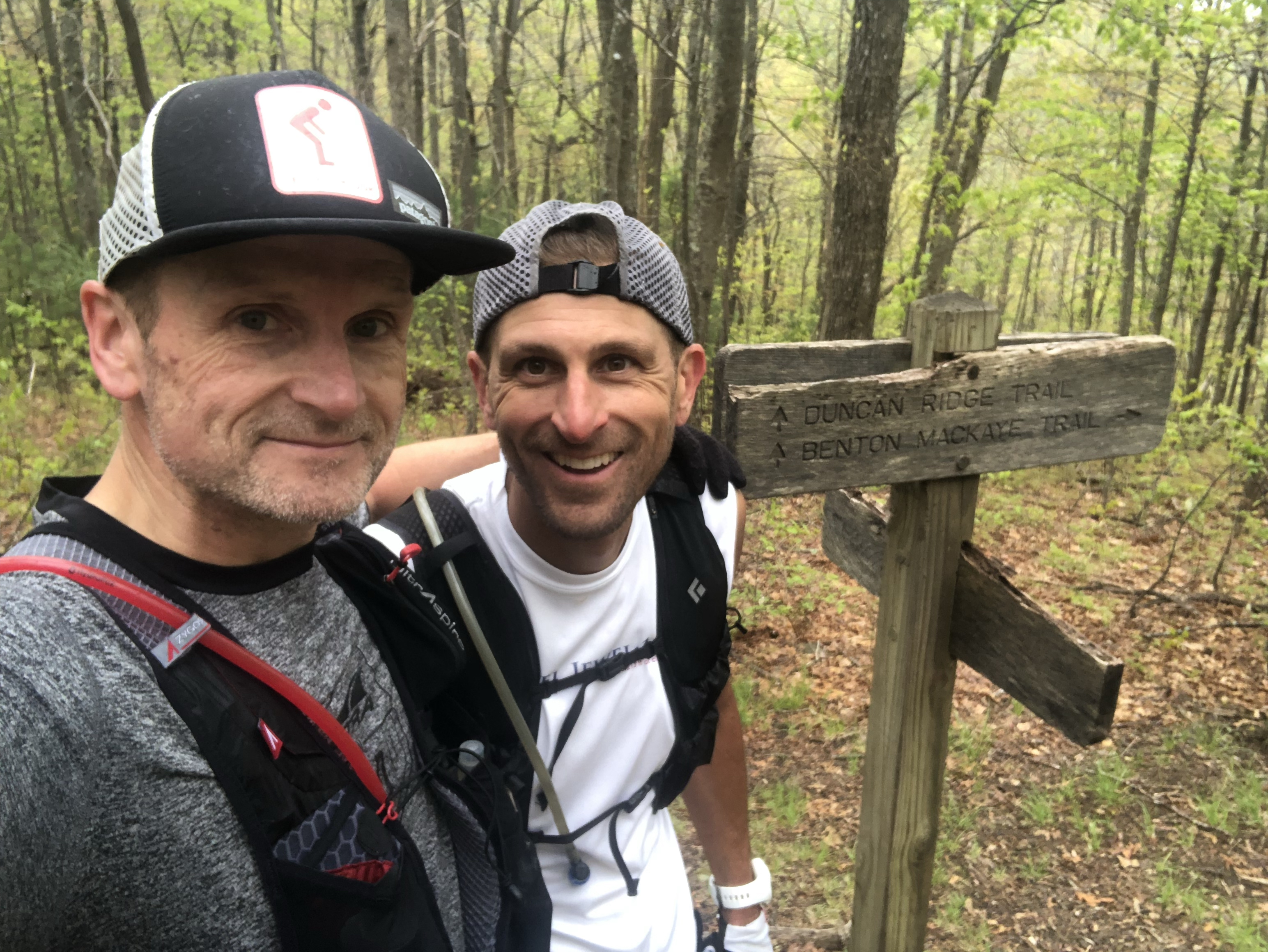
So when the state of Georgia lifted its stay at home orders and opened up its trail systems and my buddy and fellow ultrarunner Ryan M. hit me up to see if I wanted to give the Georgia Loop a go, I was all in. The Georgia Loop is considered the toughest trail run in Georgia, connecting the Appalachian Trail, the Duncan Ridge Trail and the Benton MacKaye for a 57 mile loop with over 14,000' of vertical gain. I took a day off from work, loaded up my camper van and headed for the north Georgia Mountains.
After a last minute meet up location change (the Woody Gap trailhead was still closed), Ryan told me to head to the Wolf Pen Gap trailhead, instead. I arrived there just before sunset, just in time to set up camp. Ryan had been there all day. We decided on our plan for the morning, had a couple of cold ones and called it a night. After some quality sleep, I got up around 5:30AM brewed some coffee and got myself ready for our start at daybreak. 
At 6:30AM, Ryan and I started our 57 mile adventure in a counter clockwise direction, basically heading straight up Coosa Bald on the Duncan Ridge Trail. We were doing this run entirely self-supported, carrying all food and only stashing one gallon of water at 21 miles in. For nutrition, I carried about 12 vegan gels from Spring Energy as well as 2 "accidentally" vegan Clif bars. For fluids, I had filled up two soft flasks with water and Nuun electrolytes. I also carried a Katadyn BeFree water filter bottle along with a tube of Nuun Kona Cola electrolyte tablets, my favorite electrolyte drink flavor, which Nuun re-released for a limited time. I carried all of this along with trekking poles, my Garmin inReach mini tracker, an emergency blanket and my Patagonia Houdini windbreaker in my UltrAspire Zygos 4.0. I also carried my iPhone and a GoPro for both navigation assistance (Guthook and Gaia GPS app) and photos and video, should the opportunity arise. While I managed to snap some pics, video not so much.
Ryan and I started at a conservative pace with the goal to hike every climb and just run the flats and downhills at a relaxed pace. We were here for the adventure, not to break any speed records. Of course, I didn't even make it to the top of the first false summit before realizing that I may have forgotten to lock my van. So I turned around, headed back to the van, double-checked the locks and climbed back up to where Ryan was patiently waiting.
From this point on, everything really went on pretty flawlessly. Just a short 7 miles into our run, I spotted out first (and only) black bear. Fortunately, the bear was even more startled than me as it darted off into the woods at record speed. Unfortunately, Ryan missed all of it, spending the next couple of hours hoping to catch a glimpse of a bear above or below our trail. No such luck. We had to run about 15 miles total on the Duncan Ridge Trail and even these first miles reiterated why this is considered Georgia's toughest run. Things would get slightly more difficult from here. 
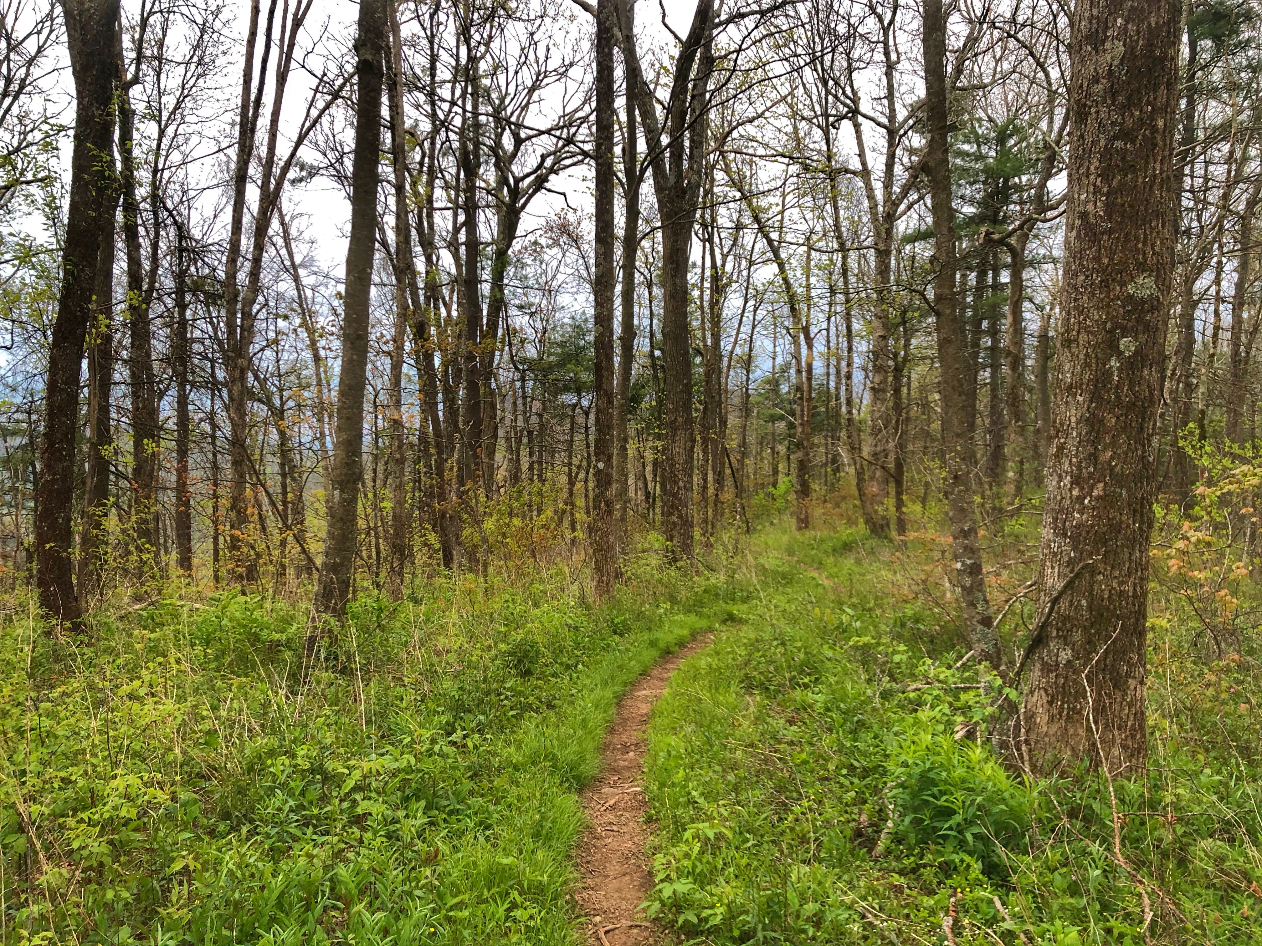
While the Duncan Ridge Trail arguably contains the toughest trail section in the entire Southeast, the so-called Dragon Spine, it sure felt like the Benton MacKaye Trail did not provide any relief. It was probably mainly related to our legs already having covered 15 miles of steep terrain, but the BMT is nothing to sneeze at. I only recall "easy" section during our entire run. Everything else was pretty much up or down, sometimes pretty technical, but never really flat or easy.
Water was pretty sparse on the DRT and the BMT did not fare much better, but I never ran dry for more than a mile or so. We knew the AT would provide more regular water sources, especially since there had been some decent rain in the days leading up to our adventure run. Once we passed the 50K mark and entered the AT, I was starting to play close attention to water sources. The sky had been overcast for most of the day, but every once in a while the sun would peek through, immediately causing an increase in my sweat rate. Overall, we had gotten pretty lucky with our weather. Temps were mostly mild and an initial drizzle of rain never turned to much more than that, even though it hung around for a couple of hours. 

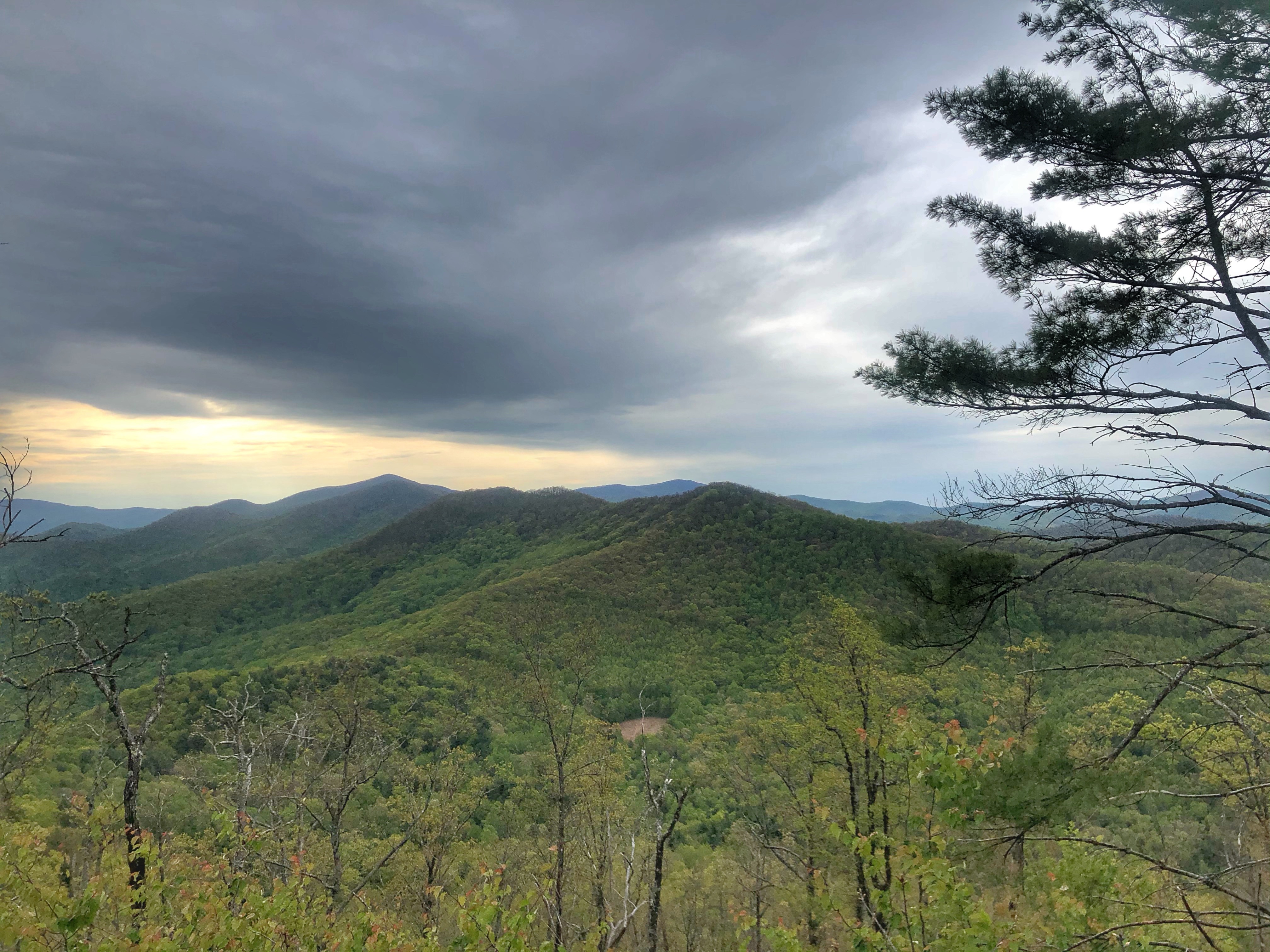
Every once in a while, the tree canopy would open up and expose spectacular views of the surrounding mountain range. With all the rain in the preceding months, the trail had also never been greener. The area was lush green more resembling the PNW than the Southeast. As the day started to warm up, I needed more and more water an my appetite to eat subsided. Before long, I would empty my bottles before reaching the next water source. At this point, I had switched from the Gaia app to the Guthook app that had the Southern AT section loaded and was a great resource to locate natural water sources along the AT. 
Most of the time, Ryan would lead the way and I would follow. He was moving a bit quicker than me and I was acutely aware not to start to push outside my comfort zone. Clearly, I didn't stick to  this plan closely enough. With about 10 miles to go and at the top of yet another climb, the efforts of the day had finally gotten the better of me. Maybe it was the lack of food intake, maybe I just wasn't as fit as I thought or maybe it was just the way ultras (even self-supported ones) sometimes play out. I had the proverbial blow up. Legs shot feeling extreme exhaustion, I needed to take a breather. We stopped for a snack break and I forced myself to eat some cookies in hopes that I was just low on sugar or something. I perked up just a little, but I knew the only way to finish this thing was to back way way off. Ryan would have been able to keep pushing but I was thankful that we stayed together. It was a slow slog from here on out.
My blowup also meant that we'd need to pull our headlamps out of our packs after all. Just as well as we had to do the final miles to complete the loop back on the Duncan Ridge Trail and this was the worst section by far. Narrow, rocky and steep. I was elated when Ryan finally recognized a road sign in the darkness, indicating that we had finally completed the GA Loop. Even walking the final 10 miles of this adventure, we still managed a respectable time of just over 15 hours. Next up, shower, beer, food and sleep, in that order. Due to poor planning on my part (i.e. lack of testing things out in my camper beforehand) I only enjoyed the beer and sleep, but that was just fine. I had completed my first "real" trail adventure since Covid started.




Add caption

07 April 2020

/

My entire packing list for a 70+ mile self-supported adventure run
It all started 3 years ago, when I first attempted SCAR, short for Smokies Challenge Adventure Run, a 72 mile traverse of the Great Smoky Mountain National Park entirely on the Appalachian Trail. It's a rite of passage of sorts or many Southeastern trail and ultra runners. It requires runners to be self sufficient for the entire route with one opportunity for crew support at about the half way point right before or right after crossing the highest point on the entire Appalachian Trail, Clingman's Dome.

Runners taking on this challenge have to make sure to not only carry enough food for 72 miles and a way to sterilize their drinking water along the way, but they must also take along all of the gear necessary to handle any and all weather conditions the trail may throw at them at a given day. The closest I had come to logistical planning like this had been for the Ultra-Trail Du Mont-Blanc in Chamonix, France, a race that requires runners to carry a significant amount gear to be able to handle serious mountain weather. Having run that particular race twice, I can attest to the need for the all of the required gear.

When we finally tackled SCAR 3 years ago, we were hit by a freak snowstorm in May, forcing us to abandon halfway through the adventure and self extract for 10 miles down closed park roads with not a soul around. We were wearing every single piece of clothing we had started the adventure with just 12 hours earlier. After an initial rain storm, followed by freezing rain and hail that turned into thick snow, we learned very quickly what gear worked and what did not. In fact, most of our gear did not work.

Since that day, I have taken on a few more self-supported adventure runs and I have learned quite a bit in the process. When we finally decided to give SCAR another go earlier this year, I was excited and ready to get to planning. I still had my old spreadsheets detailing not only each pice of gear I used, but also the weight of each piece. As you will realize very quickly when planning a self-supported run, the weather conditions, access to resources during the run, the terrain and the length of the run all play a role in the gear necessary for such an adventure and the more gear you need the more important weight becomes. You'll need to weigh purpose vs. weight vs. cost and decide for yourself how to pick and choose. I will share some of my experiences of gear choices as well as nutrition considerations for various situations.

In January, I put out word among some of my running friends that I wanted to give SCAR another go in March of this year. This would give any interested runner enough time to train and plan accordingly. Before I knew it, we had 10 runners jump at the bid to give it a go. A friend of mine quickly reserved a large cabin for the last weekend in March and all we now had to do is to start training and plan gear and nutrition needs. Not to spoil the suspense, but we all know what happened in the world right around this time and just two days before we were supposed to start our adventure, the Smoky Mountain Nation Park closed all access to all trails and toads inside the park, including the Appalachian Trail. By that time, we had already lost half the runners due to various circumstances surrounding the pandemic. However, at that point all the training and preparation had already been completed. In fact, I had already loaded up my camper van ready to go.

In this part, I will share with you how I prepare for a self-supported run. While I obviously didn't take into consideration the constraints of a pandemic, I will add some thoughts about the implications of it in situations were runners still are able to venture out into remote places. For everyone else, take this time to plan out your next grand adventure and hopefully you'll find some helpful info in here.

These are the main factors when preparing for self-supported run:

Distance
This is not just the overall distance, but also the distance between points with access to water, nutrition and possibly gear. This may include naturally occurring resources (creeks, water spigots, lakes, etc.), supplies stashed at trail heads or trail intersections, supplies bought near trail access points (i.e. general stores, gas stations, etc.) or even crew. Knowing this will help you figure out how much supplies to carry for the entirety of the trail and for each section of the route. Note for a pandemic: Avoid any outside assistance and either stash supplies yourself or carry all of them, provided you are allowed to venture out at all.

Terrain
Is the route predominantly roads or trails or a mixture of both? Is there a lot of vertical gain, is the terrain steep? Is it extremely technical or mostly flat or even surface? How about mud, sand, ice , snow? All important factors when selecting your gear.

Weather Conditions
This is not just important for your gear choices, but even more so for access to water. Self-supported runs often rely on the ability to purify water from natural sources along the way as it is impossible to carry enough water for 70+ miles, for example. Choose your season wisely. Will water sources be flowing? How about wildlife? Is it active during your targeted season. Obviously, gear is a major consideration for this as well. Will there be snow cover or even snow pack? Will there be a potential for torrential downpours. It's a good idea to find a weather app that provides weather conditions all along the route and at different elevations along the route. Temperatures can swing to the extreme even with just a 1000 feet of elevation change. Wind may be blowing on a ridge line, pushing temps a lot lower than forecasted. All these are factors to consider when planning your gear. Note for a pandemic: It would probably be wise to avoid any areas with a risk of severe weather, when the likelihood of a rescue may be more common than at other times, hence potentially putting an undue additional strain on an already strained health care system.

Wildlife
As mentioned in the previous paragraph, familiarize yourself with the local wildlife and their behavior. When are they most active? Should these times be avoided? How about snakes, yellow jackets, mosquitos, back bears vs. grizzlies, mountain lions. These should not keep you from taking on an amazing adventure, but you should be aware. Maybe you'll need to carry bug spray, bear spray, a bear bell? Note for a pandemic: The note above still applies. Avoid areas with active wildlife, if a confrontation may require you to be rescued.

Purpose
Last but definitely not least, why are you taking on this adventure? Are you trying to push your limits? Are you just wanting a different challenge? Are you trying to set an FKT ("Fastest Known Time" for a given route)? Once you know why you're doing this, you will be better equipped to make the appropriate gear and supply choices.

One very brief note on your training preparations. Be sure to train like you would for any other event or race. Replicate the terrain of the route as much as possible and train for the distance and the vertical change that you may encounter on your route. Most importantly, be sure to carry the pack you plan to utilize during your adventure run during your training and test out the actual gear as much as possible. It's no good to have the lightest and probably most expensive gear out there, if it is not practical, i.e. a rain jacket that wets out after just 30 minutes or a pack that chafes your shoulders raw after just 10 miles or even worse, brand new trail shoes that blister your feet just 5 miles into your run. With that out of the way, let's get to the actual gear and supply considerations.

Let's start with the easy stuff, your preferred running hat, top, shorts, socks and shoes of choice. Consider both comfort and utility as well as hot vs. cold and road vs. trail. Maybe gaiters are a good choice or maybe you like compression around your legs. All these are personal choices you'll need to make.

Next up, the pack. If you go far or long enough, you'll need something to carry all your gear and supplies. The size requirements are potentially driven by what pack you already own and/or by the gear you'll need to pack. Again, comfort is super important.

Next up are additional layers you may need to pack. Consider a wind breaker, rain shells, a mid layer (down or wool), maybe sleeves, gloves and a warm hat or buff. If an item can serve more than one purpose, even better. For example, if you know you'll need a rain jacket, ditch the wind breaker or if you like using multipurpose buffs, consider skipping the extra hat and use the buff for that as well. Make sure you pack the right clothes. You do not want to get caught in a rain or snow storm or rapidly dropping temps without the appropriate gear.

Next up, other gear essentials and considerations. If there is significant vertical gain, you may want to carry trekking poles. Maybe you'll need micro spikes for icy terrain? If you're moving into the night, you'll need a quality light along with spare batteries. A backup light is important, too, in case your main light source fails completely. Another hugely important thing to consider is navigation along with tracking. You'll want to consider something that can load a GPX file or similar to provide directional guidance to you, especially in remote areas. Backup batteries are important once more as is a backup paper map (and compass). Technology has come a long way, from wrist GPS watches with extremely long battery life to super small two way satellite communication devices that can be a literal life saver. Finally, you should always pack either an emergency blanket or even better, an emergency bivy as well as any necessary emergency medication. I always carry an emergency epinephrine injector as well as some anti-histamine pills to be ready for the negative effects of an insect sting allergy.
I laminated a list of water sources for SCAR to carry with me for easy access.
Finally, water and nutrition. If you can't stash water along the way or have access to crew, you either need to have the ability to carry all the water you need or you'll need to bring a water filter of some sort to purify your drinking water along the way, You can choose to carry a hydration bladder with an inline water filter, a filter bottle, a UV pen, a filter pump or purifying tablets. The options are nearly endless these ays. Next you'll need to decide the amount of calories you'll need to take in to be able to sustain proper energy levels throughout the adventure. Everyone is different, so make sure you calculate your hourly rate of caloric intake and be sure to add some extra. Be sure to bring any supplements you're used to taking, i.e. salt pills or similar and don't be afraid to pack some treats, be it candy or a sandwich or torilla. Something that can lift your spirits when you're bonking at give you that extra physical boost as well.

Now that you've decided on all the items you need, it may be a good idea to write them all down on a list of some sort, so you can be sure not to forget anything when the time comes to pack for your adventure. You may not want to be as specific as me in noting weight of each item, but you definitely want to avoid the risk of forgetting an essential item. Finally, you'll need to see if the pack you have can hold everything you need to bring and if it does, how does it feel on your back? Can you run with it? Now that you've sorted the logistics, you can focus once again on the fun part of running, the act of running itself.
Gear check list I created for my SCAR adventure.
For comments or specific gear or training questions, please feel free to hit me up directly via my blog www.ultrakrautrunning.com, via Instagram @UltraKraut or Facebook and Strava martin.schneekloth.

01 April 2018

/

The harbor entrance on Lindau island in Germany, the unofficial finish line of my adventure run.
This run was entirely unplanned...until it wasn't. A short notice work trip to Switzerland had me struggling to figure out a way to get another 100 mile training week in prep for Hellbender 100 in April while basically sitting in a plane for two of those days and suffering through jet lag, which seems to get worse with every Euro trip I take these days.
One of the earlier trail sections, wide flat gravel trail.
Even if I was going to be extremely disciplined, it would be nearly impossible to find the time to get in 100 miles. Instead, I rearranged my training plan, but I still had to rack up 80 miles for the week. When Friday rolled around, I was at 40 miles, still needing another 40 over the next two days. To make matters worse, the weather had been pretty miserable all week and Saturday looked to be the worst, yet.
Small boat pier on the Strandweg along the Alter Rhein river.
I needed to do something pretty long on Saturday or Sunday. Since there was still a lot of snow at the higher elevations and more snow in the forecast, I had to stay at the lower elevations. St. Gallen is just 6 miles from Lake Constance and I figured there must be lots of hiking trails and bike paths around. A bit of online research revealed just that. In fact, there were two major trails or paths in my immediate vicinity. One 170 bike path looping entire Lake Constance and passing through 3 countries and the Camino de Santiago or Jakobsweg. It took just a few minutes to map out a nice point to point 50K route utilizing these trails along Lake Constance while passing through 3 countries in the process.
Strandweg along the Alter Rhein river.
The route would start at the front door of my hotel in St. Gallen Switzerland across St. Gallen cathedral and take me 10 kilometers downhill towards Rohrschach, a small town at the edge of Lake Constance before continuing on more or less along the lake towards the town of Bregenz in Austria for about 30 kilometers and finally on to Lindau island in Germany, my final destination for this point to point self-supported solo adventure run.
The Rhine river.
After following the weather reports, I decided late Friday evening to do a shorter run on Saturday in case the weather got as bad as predicted and try for the solo 50K on Sunday in hopes of slightly better conditions. That would mean, however, that I would be running on Easter Sunday, so I had no idea if any gas stations or shops would be open, when I was in need for food and water during my run. Oh well, that's all part of the adventure.
The only visible sign that you've entered another country (Austria), the small road sign on the right.
I left my hotel at 7:05AM on East Sunday morning. It was raining and a chilly 42 degrees. My level of motivation was pretty low, to be honest as the day looked dreary. The weather would not change for quite a while, but I decided to just take it mile by mile, breaking down my run into little manageable chunks. Thankfully, the first 6 miles were all downhill, so all I had to do is fall forward.
Wooden covered bridge across the Alter Rhein river separating Switzerland and Austria along a green (blue) border.
I kept a relaxed pace. I was wearing my UD running vest with only a single bottle filled with Nuun. My other bottle had sprung a leak just before I took off on my run. I also carried my phone, a GoPro, passport, cash, credit card and two CLIF bars. I hoped that I'd be able to get water and food at gas stations as needed.
Rhine river with alps in the background.
I didn't realize that I would barely eat or drink anything during my run. Temperatures were so cold and wet and I was moving conservatively enough that I didn't really feel hungry or thirsty. As a result, I did not drink my bottle of Nuun until mile 20, when I stopped at a gas station, where i picked up a bottle of water, a 16oz bottle of Coke and a bag of potato chips. I figured I could use a salty snack, even if I wasn't really hungry.
Wooden pedestrian bridge crossing the Dornbirner Ache creek.
I ended up chugging my bottle of Nuun, refilling my soft bottle and dropping another Nuun electrolyte tab into the water. I also drank half a bottle of Coke and ate half the bag of chips. I almost had to force myself to do so as I was neither particularly hungry nor thirsty. After a8-10 minute stop, I shoved the left over chips in my pack and continued on.
Boat harbor inside a small Lake Constance bay.
The weather would continue to change throughout the morning. While it stayed mostly overcast, the rain would stop occasionally, allowing me to still get some decent pictures of my surroundings. It took 15 miles for me to finally start to really enjoy the run. I had settled into a nice pace and I was stopping whenever something caught my eye. A beautiful rocky beach, the Alps, interesting architectural structures, lots of things worth a second glance and a picture.
Stony beach inside a small Lake Constance bay.
As the hours went by, the paths and trails got busier and busier, both with locals out for a Sunday walk and with tourists visiting the area over the 4 day Easter holiday weekend. While I am not particularly religious, it was kind of interesting to be running on the Camino de Santiago on Easter Sunday. I slowly made my way along the lake and through 3 countries. After just under 5 hours, I finally arrived at my final destination on Lindau island,  a small island in Lake Constance connected to mainland Germany via a short bridge.
Boat harbor at Lake Constance in Bregenz, Austria.
Lindau island consists of the Altstadt of Lindau along with a train station, which made it the perfect finish line for my adventure run as I could hop on a train back to St. Gallen once I was done. While my running gear worked perfectly all day, now that I was done running, I was struggling to stay warm while trying to do some sightseeing in town before taking the train back to my hotel. I pulled my waterproof jacket out of my pack and put it on, but I was still walking around in my shorts, earning me lots and lots of surprise looks from pedestrians who were wondering why anyone would wear shorts with temps in the low 40s. 
Make shift refuel stop.
After a few more photos, I went inside the heated train station to pick up a ticket and devour a large order of fries with ketchup and a half liter of German beer (my victory beer) from a small Kebab shop inside the train station before making my way to the appropriate track for my departure. 
Small beach inside small bay outside Bregenz, Austria.
Thankfully, my run was mostly uneventful in terms of any issues. I bought the wrong train ticket initially, which is a bit embarrassing considering I am German and this was a German train station. I didn't take any wrong turns, during my run, I was able to get some food and water at a gas station when I thought I needed it and my GPS watch battery didn't die until after my run, even though I forgot to charge it all week.
Paved trail between Bregenz, Austria and Lindau, Germany.
Once Iwas sitting on the train, I immediately started to look through all of the photos I'd taken, selecting the best ones for my running blog. I looked at the map of my run as well as my running data, always fun to check out after a run. Before I knew it, I was back at my hotel, taking a hot shower and looking forward to another amazing dinner at my favorite local Vegan buffet style restaurant.
View of Lake Constance from Austria with Switzerland on the left and Germany on the right.
One final suggestion to anyone that has read this far. If you have never done a solo run, do it. Map out a course of any length, anywhere, for any reason or no reason at all. You'd be surprised how much fun it can be, especially without the pressure that can come with the participation in an official race event. Go out there and create our own adventure. I promise, you won't regret it. In fact, you will look at your surroundings differently, always wondering how you could turn this or that into your next adventure run.
Boathouse structure inside Lake Constance.

Austria-Germany border, interestingly marked only by the Free State of Bavaria sign post.

Small creek separating Austria and Germany.

Another stony beach on Lake Constance. 
Sign post identifying the final 5k of my adventure run.


Reed along Lake Constance with the Alps in the background.

Lake Constance with the Alps in the backdrop.

Church on Lindau island.

Market place on Lindau island.

View from Bridge providing access to Lindau island.

Beautifully decorated building in the center of Lindau island.

The harbor entrace on Lindau island.

Unofficial finisher selfie at harbor entrance of Lindau island.

Course map.

Boat harbor on Lindau island.

Another view of the harbor on Lindau island.

US STATES WITH 100 MILE RACES COMPLETED (33)

COUNTRIES WITH ULTRAMARATHONS COMPLETED (15)

Visited Countries Map by Fla-shop.com

RACE CALENDAR

  • Gila 100M (Silver City, NM) - October 17, 2026 REGISTERED
  • Loup Garou 100M (Ville Platte, LA) - December 5, 2026 REGISTERED
  • Southern States 200M (Delta, AL) - March 17-21, 2027 REGISTERED
  • Cocodona 250M (Black Canyon City, AZ) - May 2, 2027 REGISTERED
  • Huron 100M (Grass Lake, MI) - June 12, 2027 REGISTERED
  • Lavaredo Ultra Trail 120K (Cortina d'Ampezzo, Italy) - June 25, 2027 REGISTERED
  • Hardrock 100M (Silverton, CO) - July 9, 2027 LOTTERY

SPONSOR

SPONSOR

YOUTUBE CHANNEL

TRANSLATE

PAGEVIEWS

| Free Blogger Templates